28.10.2013
River Thames Joins South Pole and Red Square on Google Street View
• Port of London Authority teams up with Google to capture images of iconic river
• River Thames is the first river in Europe to be included on Google Street View
• First time 360 degree panoramic views of the length of the Thames now available on Google Maps
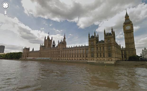
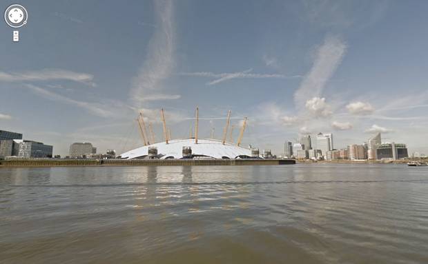
Panoramic views of the River Thames today (Monday, 21 October) join ranks of the penguins of the Antarctic and the Grand Canyon on Google Street View for the first time. The river is the latest iconic global location to appear on Street View after the Port of London Authority (PLA) teamed up with Google UK to send its ‘Trekker’ camera down the Thames.
 |
 |
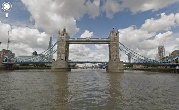 |
The Thames is the first river in the UK and Europe to be mapped by Google’s Street View technology, which provides 360-degree panoramic imagery to users across the world on Google Maps. While Street View cameras had voyaged to Moscow’s Red Square, the explorer, Scott’s, Hut on Ross Island and some of the world’s highest peaks, they were yet to make their way down England’s longest river until now.
The 360-degree photographic views of the river are live on Google Street View, which viewers will be able to find on www.maps.google.co.uk or on https://www.google.com/maps/views/home.
The PLA approached Google to map the iconic river, which has been at the centre of London life for centuries, offering a new perspective on the capital to Internet users around the world. The Thames serves as the artery of London, being a trade route since Roman times and more recently serving as the setting for the 1,000-strong vessel flotilla to mark the Queen’s Diamond Jubilee.
In order to capture the river in all its glory, the Google Trekker camera was attached to the PLA’s hydrographic surveying vessel, Yantlet, which journeyed almost 30 miles up and down the river from Woolwich to Richmond. The trekker is a 4ft, 18kg (40lbs) backpack, fitted with a 15-angle lens camera that takes 360-degree pictures every 2.5 seconds. It is designed to capture 360-degree imagery that the Street View car and Trike, a tricycle-based camera system, can’t typically reach, such as narrow pathways and now waterways. Google first used the technology to capture images of the rough, rocky terrain of the Grand Canyon, and recently started capturing the extensive canal network across the UK.
John Pinder, the PLA’s port hydrographer, said:
“It’s great that people across the world will now be able to take a virtual journey down the Thames, enjoying a unique perspective of London. The River Thames now has a place alongside some of the world’s most famous locations on Street View and we’re proud it is the first river in Europe to be mapped using the technology.”
Ed Parsons, Geospatial technologist at Google UK, said:
“The Thames is the central tributary that Londoners like myself and tourists like to navigate by. The river also offers some of the most scenic and iconic views of London from arguably the best vantage points the city has to offer, and we are thrilled to be able to work with the PLA to share this with users from around the world through Street View.”
Street View includes 360-degree panoramic views from more than 3,000 cities across 53 countries including parts of the Arctic and Antarctica with users from across the world viewing Street View imagery millions of times every day.
- End -
About the PLA
• The PLA oversees navigational safety on 95 miles of the tidal Thames, from Teddington Lock to the North Sea. The river is home to the second biggest port in the UK, the busiest inland waterway for freight, passengers and a centre for sporting events.
• There are over 230,000 commercial and leisure vessel movements on the Thames every year. The commercial vessels provide trade links to over 80 countries around the world, from Chile to Mauritius, Honduras to Fiji.
• More information on the PLA: www.pla.co.uk
About Google Maps
• Google Maps offers powerful, user-friendly mapping technology and local business information in the context of satellite imagery, street level imagery, and user-contributed content. Google Maps is the most popular online mapping site in the world and can be accessed at maps.google.co.uk
• For more information on Street View and the Google Trekker visit: http://www.google.com/maps/about/partners/streetview/trekker/
Press contact details:
PLA: Alistair Gale, 07711 440 736, [email protected]
Google UK: Laurian Clemence, [email protected]
