Shop
Mariners' Guide to Bridges on the Tidal Thames
.jpg)
Currently out of stock in print, the June 2012 edition of the Mariners' Guide to Bridges on the Tidal Thames provides an overview of navigating London's bridges, and highlights the safety issues associated with this challenging environment. The book covers every bridge in detail, each presented on a double page; illustrating the bridge with a photograph, side elevation drawing and digital chart extract. The particular issues associated with navigating through and in the area around the bridge completes each entry.
Also included in comprehensive appendices are bridge clearance tables, silhouettes, tidal set and other useful information for the navigator.
A PDF of the Mariners' Guide to Bridges on the Tidal Thames is available here for free.
Chart Folio 1: Teddington to Putney
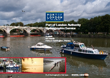
The PLA has re-compiled its series of A0 1:1250 and 1:2500 scale charts into A2 size 1:2500 and 1:5000 colour charts more suitable for navigational use. These are issued as two folios of charts, covering Teddington to Putney (charts 301 - 312) and Wandsworth to Margaretness (charts 313 - 325).
In order to support effective passage planning, the PLA recommends that, where the size and construction of the vessel allows, all commercial, inland waterways vessels carry the largest, appropriate scale of chart for their area of operation. Read more...
£50.00 + p&p £15.00
(1st class postage for UK customers)
£50.00 + p&p £20.00
(1st class postage for customers outside the UK)
Individual Charts from Folio 1
Chart 301-306 Teddington to Putney 1 (A2 Size)
For UK customers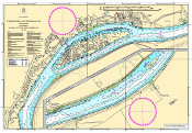
£10.00 inc p&p
Chart 307-312 Teddington to Putney 2 (A2 Size)
For UK customers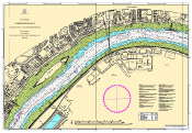
£10.00 inc p&p
Chart Folio 2: Wandsworth to Margaretness
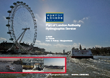
The PLA has re-compiled its series of A0 1:1250 and 1:2500 scale charts into A2 size 1:2500 and 1:5000 colour charts more suitable for navigational use. These are issued as two folios of charts, covering Teddington to Putney (charts 301 - 312) and Wandsworth to Margaretness (charts 313 - 325). Read more...
£50.00 + p&p £15.00
(1st class postage for UK customers)
£50.00 + p&p £20.00
(1st class postage for customers outside the UK)
Individual Charts from Folio 2
Chart 313-319 Wandsworth to Margaretness 1 (A2 Size)
For UK customers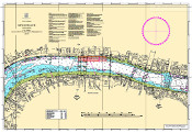
£10.00 inc p&p
Chart 320-325 Wandsworth to Margaretness 2 (A2 Size)
For UK customers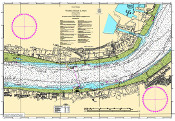
£10.00 inc p&p
Individual Charts - Woolwich to Southend-on-Sea
Chart 326-334 Woolwich to Tilbury (A0 Size)
For UK customers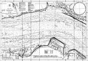
£20.00 inc p&p
Chart 335-343 Tilbury to Southend-on-Sea 2 (A0 Size)
For UK customers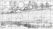
£20.00 inc p&p
Individual Charts - Tidal Creeks
Chart 376-386 Tidal Creeks
For UK customers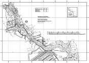
£20.00 inc p&p
Tide Tables and Port Information Book 2024
Tide predictions for Walton-on-the-Naze, Margate, Shivering Sand, Southend-on-Sea, Tilbury, North Woolwich and London Bridge (Tower Pier) for 2024. General information on the Port of London and the Port of London Authority. Download the 2024 PDF for free. See all our online tide tools here.
£3.00 inc p&p
(1st class postage for UK customers)
Passage Planning Guide
The ultimate ship Passage Planner for the tidal Thames
Packed with crucial guidance for ships navigating the tidal River Thames and its estuary, this quick reference PLA passage planning chart features:
- Pilot Boarding Areas and Pilot Services
- Vessel Traffic Management in the Thames and Medway approaches
- Passage Planning requirements for special classes of vessels
- VHF channels and Reporting Areas
- Transit requirements for the Thames Barrier and Tower Bridge
Produced for use in conjunction with nautical charts and publications, The Mariners' Passage Planning and Routeing Guide is an essential piece of kit for any ship planning to visit the Thames.
Click here to view a sample copy. Note - this cannot be printed. Copies of the Passage Planner are available to purchase from Bookharbour.
For more information, or to order a copy, please visit the Bookharbour website.
